My QSL card
Table of Contents
Front
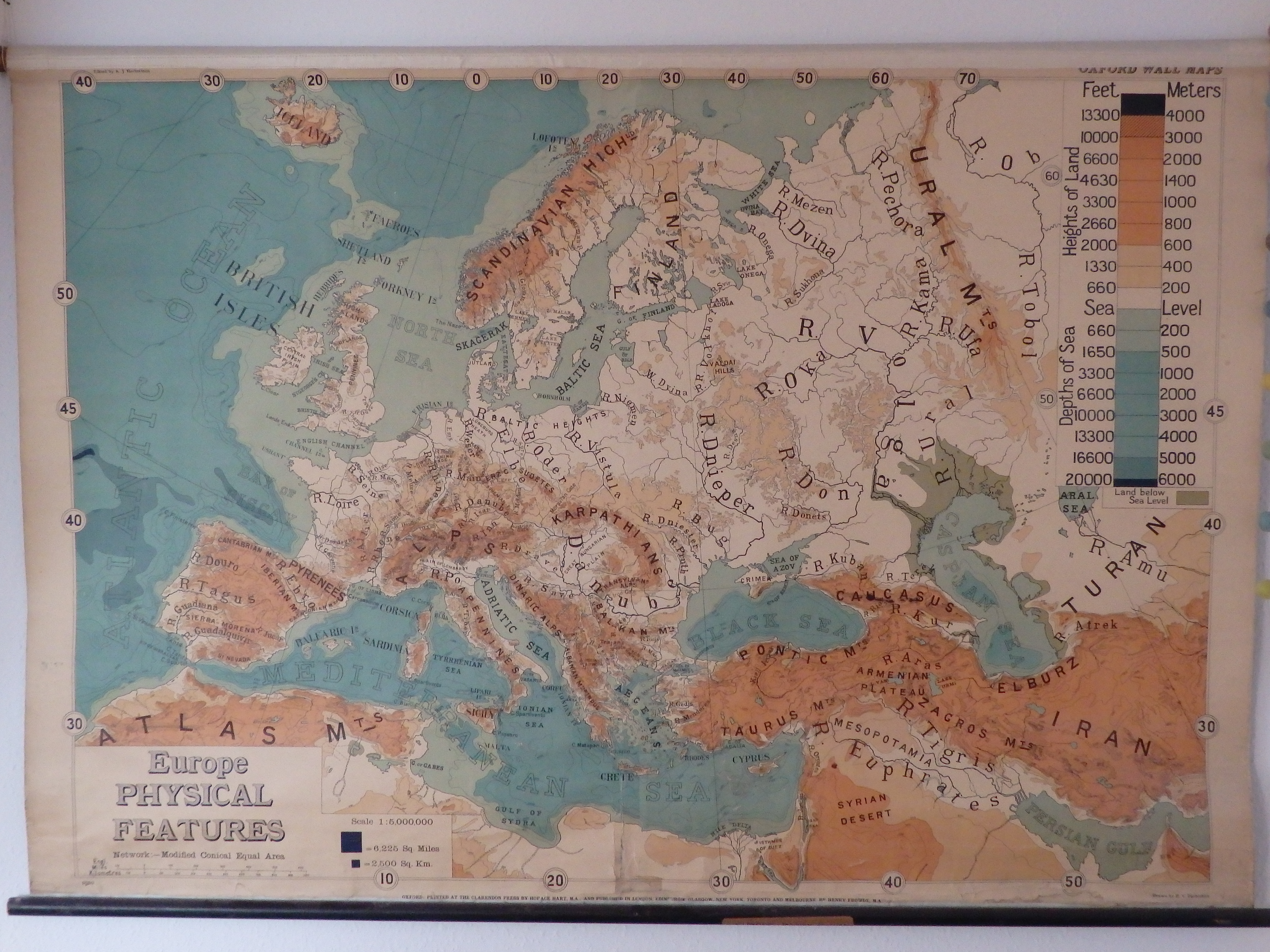
(Click to enlarge)
The front of my QSL card is based on a beautiful old map I got as a present some 25 years ago. A physical-features-map of Europe, published in 1910 in Oxford (UK), but already with mixed metric and imperial units of measurement.
One thing on this map that puzzled me for years and still does: Why on earth is a square with sides of 78.898669 miles helpful as a scale-indicator ? The little square with sides of 50 km helps me (even when I would have used a 100x100km² square); but 6225 sq.miles ? Something like three-quarters of the area of Wales ?
A picture of a part of this map was decorated with some old, but not-yet-antique, "tools of the trade" of radio-amateurs. You want to see the final picture? Lets make a QSO!
Back
An example of a QSL card from me, confirming a hypothetical QSO between
my own two calls:
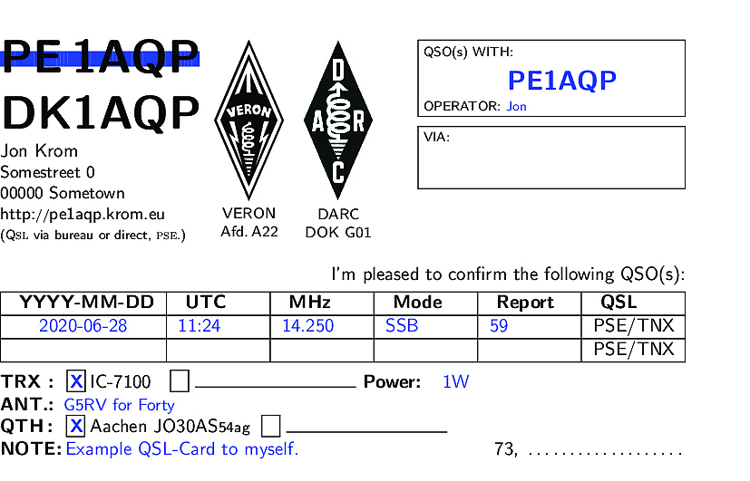
(Click to enlarge)
The left-margin is so small to compensate for the paper-handling of my printer.
LaTeX Source Details
The back of my QSL card carries, as usual, all information about the QSO that's being confirmed.
This print is generated with LaTeX, which allows me to tune and adjust content and layout as and when the need arises. So are secondary suffixes like "/A" or "/P" to my own call automatically generated when my logbook indicates that these are required.
Origin
The LaTeX source for this QSL-card was originally based on work by Fabian Kurz, DJ1YFK, but was over time seriously re-edited. The produced layout still looks somewhat similar.
LaTeX Macro Trick
In this LaTeX source I use a LaTeX-macro "trick". It is a variant of a common structure in LaTeX-class and -style files. Using it in this way has some advantages:
- It is more understandable, acceptable and reproducible by people new to LaTeX (not everybody wants to write their own LaTeX-class-file).
- Processes that extracts QSO data from a logbook (be it scripted or manual) only need to generate minimal data files with obvious keywords. These processes don't need to worry about the rest of the LaTeX source.
In the preamble of the main source file "qsl.tex", I define a number of new commands like these:
% qsl.tex
...
\newcommand{\VTOCALL}{}
\newcommand{\TOCALL}[1]{\renewcommand{\VTOCALL}{#1}}
\newcommand{\VTOOP}{}
\newcommand{\TOOP}[1]{\renewcommand{\VTOOP}{#1}}
...
These define a variable, such as VTOCALL, and a macro to assign a value to that variable. Shortly before starting the document, we include a data file:
% qsl.tex
...
\InputIfFileExists{data.tex}{}{}
\begin{document}
...
And in that data file, we (only) call on one or more of these re-defining macros:
% data.tex
...
\TOCALL{PE1AQP}
...
In the main source file, we use these variables in this way:
% qsl.tex
...
\framebox[50mm][l]{\parbox[l][12mm]{50mm}%
{ \scriptsize QSO(s) WITH: \\
\Large \textbf{\-  \hfill \textblue \VTOCALL \hfill  }
\vfill
\scriptsize
OPERATOR: {\textblue \VTOOP}
}}
...
Which would create the framed box in the top-right-hand corner of the example QSL shown above. To generate that whole example, we need a data file like this:
% data.tex
\FROM{DK}
\WATT{1W}
\TOCALL{PE1AQP}
\TOOP{Jon}
\AQRG{14.250}
\ANTENNA{G5RV for Forty}
\AMODE{SSB}
\ADATE{2020-06-28}
\ATIME{11:24}
\ARST{59}
\QSLCOMMENT{Example QSL-Card to myself}
When generating such a data file (by hand or with a script extracting it from a logbook), one can simply overwrite the file, if it already happens to exist. This data file carries short-lived, transient data, that only needs to exist during the preparation of a printed card.
Logo's
The DARC logo, as I use it, was downloaded from the DARC website.
The VERON logo was similarly downloaded from a VERON website. But the logo as it stands was not directly usable. The white lines in between the large black areas are too fine, so that the bleeding of the printer-ink fills these white details.
I know, I should have invested in another printer, used better ink or bought cards on more expensive paper. But the following worked for me:
I converted a large version of this logo into an SVG file, hand-tuned these SVG definitions and re-adjusted all white areas to be wider. Lastly I re-converted this SVG back into a PDF. This version of the logo is on screen visibly "clunkier" than the original, but at least the society's name is still readable after printing.

Downloads
The current version of my LaTeX source file can be found here.
The DARC logo I used can be found here.
And the modified VERON logo can be found here.
As a member of these two societies, I have some right to use these logos. If one or both these societies consider this re-publication a violation of their copyrights, please inform me.
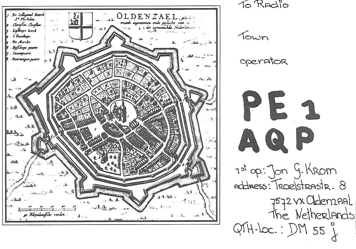
My old card
For completeness, also a picture of my old QSL card. Hand-written in 1977, by my sister (I never had such a neat, readable handwriting).
 ……
…… 
The old, obsolete "QRA locator" DM55j overlaps more-or-less with the modern Maidenhead QTH locator JO32lh.
The map on the front of this old card was a copy (of a copy, of a poor copy, …) of a historic 17th century map of Oldenzaal. Note: North to the left. I believed at the time that it was by "Willem Blaeu", 1626. I've later seen it attributed to "Nicolaas ten Have", 1648.